Hydrography
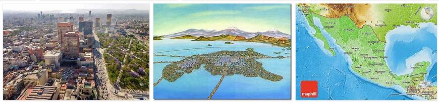
Formerly a good part of the territory of the Federal District was occupied by the lake system of the basin of Mexico. This was formed more than a million years ago with the appearance of the Sierra de Chichinauhtzin, which dammed the rivers that flowed to the south and caused the waters to accumulate forming a large lake; Later, the basin was opened by human work through the construction of the Huehuetoca and Nochistongo pits, in the State of Mexico, to divert the Cuautitlán River, which was the one that caused the floods at that time. The decision to dry out the lake system was made during the viceregal era. Although these works were carried out as a result of the flood of 1629, they were unable to prevent Mexico City from being flooded repeatedly between the 17th and 18th centuries.
On March 17, 1900, President Porfirio Díaz inaugurated the Valle de México Drainage System, which continues to function and prevents the growth of bodies of water in the capital’s soil. The last remnants of the water bodies are the canal systems that irrigate the chinampería of Xochimilco and Tláhuac, as well as the wetlands of Tláhuac.
From the construction of the great works that had as their purpose the desiccation of the lakes, the basin of Mexico was artificially integrated by means of both the Grand Canal del Desagüe and the Cuautitlán river, into the Moctezuma river basin, which is part of the of the hydrological region of the Pánuco river. The exploitation of water resources for human and industrial consumption purposes led to the disappearance of the springs in the surrounding areas.
During the 19th century, the Chapultepec springs disappeared. In the 20th century, many of the springs in Xochimilco and Atlapulco were channeled to supply water to the city center until they were exhausted. Since the 1980s, the Xochimilco, Tláhuac and Míxquic canals have been fed with treated water from the Cerro de la Estrella plant.
The water from the rivers that still flow down to the Federal District is led to Lake Texcoco or the Grand Canal del Desagüe to be drained into the Gulf of Mexico, through the Tula-Moctezuma-Pánuco system. The only waterways that survive in the federative entity are born in the Sierra de las Cruces or in the Ajusco, and they are of little flow. Many of them run between ravines that have been occupied by human settlements, which endangers both the residents and the ecosystems associated with the river. Examples of these rivers are: San Joaquín, Tacubaya, San Angel, Barranca del Muerto, Los Remedios, Río Hondo, Mixcoac, Magdalena, etc. The longest of these rivers is the Magdalena, which runs through the Los Dínamos protected area, before being piped and flowing into the Churubusco River.
Relief
According to the National Institute of Statistics, Geography and Informatics (INEGI), the territory of the Federal District is located in the geological province of Lagos and Volcanes del Anáhuac. The northern limit of the Federal District is given by the Sierra de Guadalupe, of which the Cerro del Tepeyac is part. Towards the eastern center of the Federal District is located the Sierra de Santa Catarina, a chain of extinct volcanoes whose highest point is the Guadalupe or El Borrego volcano, which rises 2780 meters above sea level. In some descriptions of the capital’s geography, the Cerro de la Estrella is usually included as part of the Sierra de Santa Catarina.
The flatness of the Valley of Mexico, in which most of the residents of the Federal District settle, is only interrupted by small hills and hills, of which the Peñón de los Baños stands out, located near the International Airport of Mexico City.. Further southeast, at the exit to Puebla, rises the Old Rock.
In the west of the city rises the hill of Chapultepec. It is a small mountain that marks the beginning of the mountain ranges that run through the Federal District from the west to the southeast, and separate the Valley of Mexico from the valleys of Toluca and Morelos. The Sierra de las Cruces is part of that system, most of the rivers that still cross the Federal District descend from it.
To the east of the Sierra de las Cruces is the Ajusco volcano, which is the highest peak in the Federal District, and gives its name to the mountain range that closes the basin of Mexico to the south. This mountain chain belongs to the Neovolcanic Axis and is also called the Sierra de Ajusco-Chichinauhtzin. Among others, the Xitle, Chichinauhtzin, Tláloc and Teuhtli volcanoes are part of it. The mountain range of the Ajusco houses several valleys of cold land in which its residents practice agriculture of wheat, oats and corn. The most important of them is the plateau where Parres sits, in Tlalpan; and the Milpa Alta valley, which rises from Tecómitl to San Pedro Atocpan, between the slopes of the Teuhtli and Tláloc volcanoes.
Climate and environment
Due to its height above sea level, the Federal District occupies climates that range from temperate to cold humid and alpine tundra in the highest parts of the southern mountains. The urban area has a temperate rainy climate, with temperatures that can exceed 28 ° C on some days in late spring and temperatures that can drop to 0 ° C or less in January. The wet season in the Federal District runs from May to November, although the rainfall is greater between the months of June and August. The last snowfall over Mexico City occurred on January 12, 1967, when it snowed throughout Mexico City. The pattern of rainfall indicates that they are more abundant the higher the altitude of a site. For this reason, the lower parts near the lake of Lake Texcoco tend to be drier than the summits of the Ajusco. In the same way, the altitude conditions the temperature and the ecosystems in the Federal District. The area that includes the north of Iztapalapa, the territories of Iztacalco and Venustiano Carranza and the east of Gustavo A. Madero is the driest and most temperate region. In contrast, the summits of Chichinauhtzin and Ajusco are covered with pine and oak forests, where it is still possible to find some wild animal species such as the teporingo (endemic to the volcanic regions of central Mexico), rattlesnake and birds of different species.
According to Softwareleverage.org, the advance of the urban area has endangered all the ecosystems that existed in the Valley of Mexico. The first to suffer the predation of the human race were the lakes. Associated with them were groves of ahuejotes, an endemic species of the lakes of Mexico. They were also the home of numerous aquatic species, such as the axolotl or herons, which were persecuted until their disappearance from the Valley of Mexico.
All major mammal species disappeared from the mountains, especially deer and some genera of canids that were hunted to market meat or to defend livestock. Smaller species take refuge on the slopes and caves of the hills, such as bats, various kinds of rodents and poisonous and other harmless snakes. By the 1980s, Mexico City’s environmental situation was on the brink of ecological disaster. The growth of industrial activity made the atmosphere of the once most transparent region of the air (according to Alfonso Reyes) one of the most polluted on the planet. The problem of water supply became more evident, since the city does not have its own and sufficient sources of the liquid, and the demand of the population and the industry exceeded the supply.
Among the first measures that were taken to alleviate the situation somewhat was the introduction of an air quality measurement system (known as IMECA). The measurement results indicated that air pollution could cause serious health problems for the residents of the capital. For this reason, complementary measures were taken aimed at reducing atmospheric pollutants, and others at the ecological recovery of the Federal District. For example, the Hoy no circula program was implemented so that people would stop using their cars once a week (two, on days when there was an environmental contingency).
As a complement to the above, some undeveloped regions of the Federal District were recovered. In 1986, more than half of the capital’s territory was declared an Ecological Reserve Area by President Miguel de la Madrid Hurtado. In later years the same declaration was issued for other areas of the Federal District. Despite all this, the pressure of the city keeps the protected areas of the Federal District in danger.