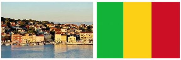
THE STATE
Independent since 1960, Mali is a republic. With the entry into force of the Constitution, approved by referendum in 1992, the country has given itself democratic institutions, trying to get out of a long political crisis due to the succession of two dictatorships. The President of the Republic is elected by direct suffrage for 5 years; legislative activity is carried out by the National Assembly, which is also elected by direct suffrage every 5 years. The judicial system is based on French law and local customs. Justice is administered, in its highest degree, by the Supreme Court, based in Bamako and divided into two sections: the first competent in civil and criminal matters, while the second competent in administrative matters. Subsequently we find a Court of Appeal always based in Bamako and two courts of first instance. In the judicial system of Mali, the figure of the justice of the peace is important, but he has limited competences only for civil trials. The death penalty is in effect, but executions have not taken place since 1980. The armed forces are divided into the three traditional weapons. Although the country has no access to the sea, there is a small navy contingent operating on the Niger River. The paramilitary forces are in charge of internal security. Military service is carried out on a selective basis and lasts for 2 years. Starting in the 1980s and throughout the following decade, an intense educational program was implemented, but in 2006 the illiteracy rate was still extremely high (73.8%). Primary education is free, begins at the age of 7 and lasts for 6 years. According to andyeducation, secondary education also lasts 6 years and is divided into two cycles of 3 years each. There are numerous institutes that provide technical or professional education; there is a university in Bamako.
TERRITORY
Territorially Mali extends between the first reliefs of Guinean Africa and the massifs of the central Sahara. In the intermediate section it includes wide plains and a characteristic depression area, the one that attracted the course of the Niger, giving rise to the wide internal delta of the river. This is the historical region of the country and the most characteristic: the Massina. It was formed, structurally, by subsidence, that is, by phenomena of crustal subsidence characteristic of the African mass, and was then gradually filled by the floods of Niger and its major tributary, the Bani. In the central section of the country, located at an altitude of less than 350 m, the recent and Pleistocene alluvial covers predominate, forming a flat and expansive plain although in some cases there are outcrops of rocks, ancient Inselberge that emerge from the floods also in the same delta. The rock formations that make up the northern and southern sections of the country, averaging 400-800 m high, are varied. They are mainly sedimentary and date back to the Paleozoic, Mesozoic and Cenozoic, eras in which the African territory was submerged in various times by the sea, an epicontinental sea that in the Cenozoic was an immense lake. The sedimentary covers obliterate the archaeozoic substratum, a rigid plateau of crystalline and schistose rocks that emerges both to the N, in the Adrar des Ifôghas massif, both to the S, on the reliefs that continue the Guinean ones. In the same areas there are granite formations, intrusive, and effusive formations connected to the crustal perturbations that occurred with the birth of the internal depression. In relation to this constitution, the Malian territory presents a certain variety of forms linked to geology, even if structurally poor in articulations. The South is a single large slope with a slight slope broken by rocky escarpments and by the valleys of the Niger and its tributaries. The central area, the vast plain built by the river, is rich in the elements of the fluvial morphology; has a fossil delta and a live delta, which during the rains is regularly flooded by floods from Niger: it is an amphibious environment, made changeable by the formation of unstable sandy islands, to which the wind power supply from the Sahara contributes. The delta is bordered to the N by the first Saharan plateaus, carved by Niger finding an outlet towards the E and then towards the S, and giving rise to the large and characteristic loop, the boucle, which makes it a river with a singular course. After Tombouctou (Timbuktu), Niger flows between rocky banks, along which the desert wind accumulates sand dunes. The northern Saharan section of the country is dominated by the Adrar des Ifôghas, which does not exceed 1000 m in height, and by other reliefs and hamadas that border sandy surfaces; valleys that represent the course of ancient Saharan rivers mark the whole region, flowing into Niger, to which, however, they no longer give any water tribute. The southern and southwestern sectors of the country belong hydrographically to the Niger and Senegal basins; both are characterized by rocky escarpments that interrupt the flow of rivers.
